Transit Healthy.
Abstract
Why do we need a healthy transit?
Research
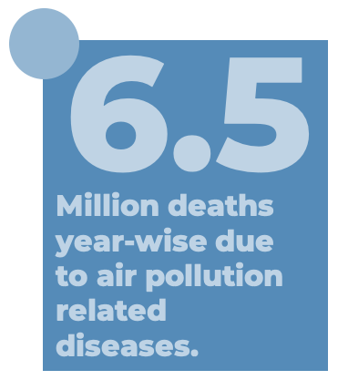
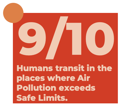
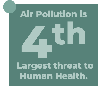
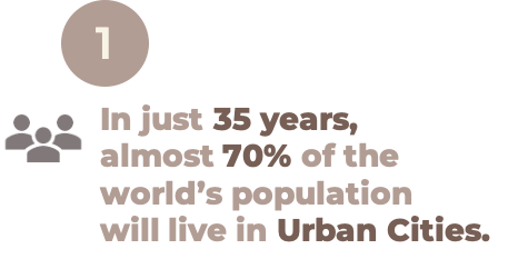
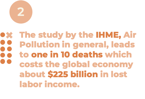
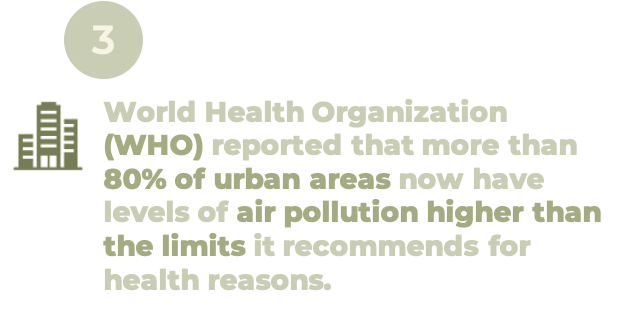
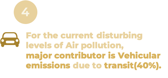
Here are some
facts to think about.
What is Lacking?
A Centralized Air Monitoring system, which holds the live pollution levels of locations on map. Users can view the live pollution levels of location within cities. A better navigation system that keeps into account the pollution level of the places along the route, and keeps you on the healthiest one.How can we make the Transit more Healthier and Sustainable for future generations?
Solution
We propose a Centralized Air Pollution Metering System.
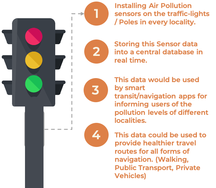
With this air monitoring sensor technology available, applications on smartphones can leverage the sensor data to collect highly localized, real-time data on air pollution. That can help them keep a check of their surrounding atmospheric conditions as well as help them plan their outdoor activities.
An Environmental Friendly Commute.
Streetwise recording of AQHI.
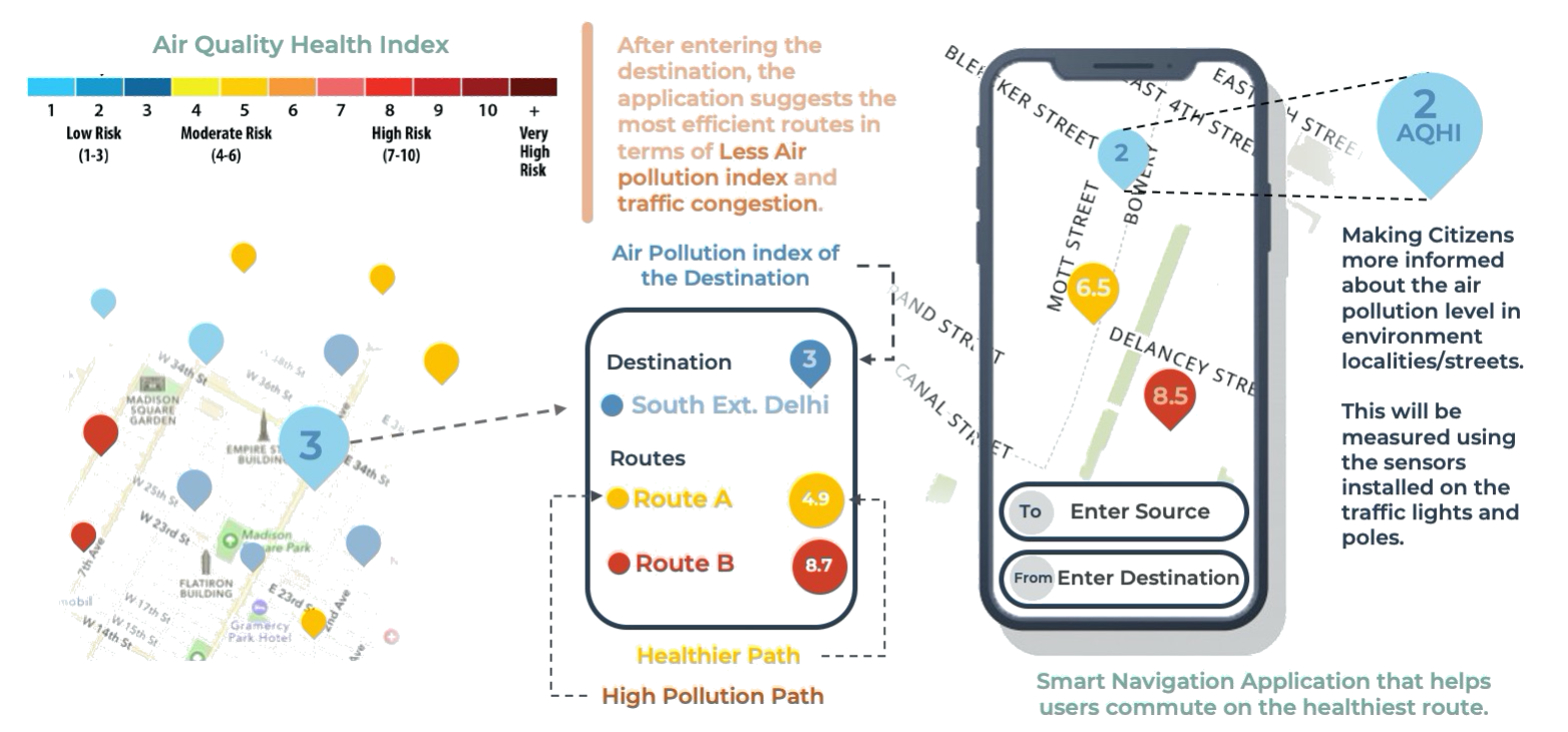
Every street light corner would have an AQHI sensor installed on it. The sensor data would be consolidated and sent to common servers for evaluation and analysis. Also, this data would be utilized by the Navigation apps for a healthier and smarter transit.
![]()
Zonewise recording of AQHI.
The real-time data collected from the sensors is consolidated on a common server and then it is used to classify the cities into healthy / moderately healthy & unhealthy zones. Navigation apps would notify users of such labels and direct them to the healthier
routes, thereby reducing the AQHI level of more polluted areas by neutralizing the traffic accordingly.
![]()
So how the city looks with Air Pollution filter on?
The following aerial view of the city overlayed with pollution level gradient layer depicts the variation of Air Pollution from zone to zone. Warmer colors (Reddish - Orange) depict significantly higher Air Quality Health Index (AQHI) and cooler shades (Blueish) represent areas with lower AQHI.
Health Based Navigation Systems.
Healthy routes (routes with lower value of AQHI) would become a prioritized need in the future. Transit apps would use this feature for routing travellers from source to destination.
Reflections
Scope to improve.
Keeps the Concerned Environment Agencies and Industries informed about the pollution level of the city as well as their functional area so that they can keep the levels well under limits. This can be used in Schools to spread awareness about how air pollution is affecting our atmosphere.Healthier way to commute through the city.
Previous Navigation systems didn’t take health into consideration. Transit Healthy provides suggestions to the users about the healthy paths to take.Trend Analysis and Global Metric of Breathing Hygiene.
The data obtained from the sensor grid throughout the city could be used to study the trend of air pollution variation throughout the generations to take a step towards a sustainable future. With the obtained sensor data, it would be possible to compare the cities in terms of air cleanliness at global level, more accurately, thereby introducing the possibility of taking better actions for a clean, hygienic and better future for us all.Real Time Analysis.
Its unique because it is not only relying on the statistical data available, but captures information from sensors at real time that enables one to take urgent measures when necessary.Makes you an informed citizen.
Keeps the citizens informed so that they can understand about their city pollution levels and take small actions from their side to keep their localities low on pollution. Also while visiting new places, they have healthier choices about routes as well as the destinations they’ll be travelling to. People who suffer from Asthma can use the navigation app to locate and avoid really polluted places.Maintains the balance.
Maintains traffic congestion and keeps the pollution levels of the entire city neutralized. This is because the navigation routes suggested for transit are less congested and consist of less polluted intermediate zones. This way, highly polluted areas don’t pollute further as traffic is redirected to less polluted routes.